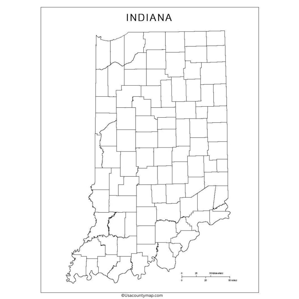
The Blank Indiana County Map is used to examine the state geography interactively without any boundary lines. They can use a Blank Indiana Map in class, when planning a visit, or even in the course of studying. It also offers a chance to showcase rote wonders, such as the Great Lakes shoreline, the Hoosier National Forest, and several state parks. Teachers commonly use a Blank Indiana Map in lessons to allow students to develop their map skills, find out general geography, and learn about political divisions in their area.

Marking counties, rivers, and cities can deepen students’ spatial thinking and make the map a worthwhile resource during geography lessons, quiz creation, or assignments. Blank Indiana County Map, on the other hand, is helpful for business professionals, tourists, and researchers to represent or plan out specific areas of the state, routes, etc. As a result, all these features make a Blank Indiana Map a perfect tool for many more educational, professional, and personal use needs, allowing you to understand the vivid, diverse landscape and geography of Indiana.
Blank Indiana County Map
Indiana, a Midwestern state, is known for its beautiful agricultural history, varied landscape, and bustling cities. It borders the states of Illinois, Kentucky, Ohio,o and Michigan, and its capital and largest city is Indianapolis. Indiana is known for its manufacturing, especially for cars, and its large production of agriculture, such as corn and soybeans. Illinois has an assortment of geography, from flat farmland to rolling hills and woods. Basketball is one of the most popular sports in Indiana, and the Indianapolis 500 is considered one of the major events in motorsport.
| City Name | Population | County | Area (sq mi) | ZIP Code(s) | Additional Information |
|---|---|---|---|---|---|
| Indianapolis | 880,000+ | Marion | 368 | 46201–46298 | State capital and largest city; known for the Indy 500 and strong sports culture. |
| Fort Wayne | 270,000+ | Allen | 110.6 | 46802–46899 | Major manufacturing center; second-largest city in Indiana. |
| Evansville | 117,000+ | Vanderburgh | 47.9 | 47708–47737 | Located on the Ohio River; regional hub for finance and healthcare. |
| South Bend | 103,000+ | St. Joseph | 41.9 | 46601–46699 | Home to the University of Notre Dame; historical industrial city. |
| Carmel | 100,000+ | Hamilton | 48.5 | 46032–46082 | Suburban city known for parks, schools, and high quality of life. |
| Bloomington | 80,000+ | Monroe | 23.3 | 47401–47408 | Home to Indiana University; vibrant college town with arts and culture. |
| Hammond | 77,000+ | Lake | 22.8 | 46320–46327 | Located near Chicago; strong industrial and shipping economy. |
| Lafayette | 71,000+ | Tippecanoe | 29.3 | 47901–47909 | Known for Purdue University and a growing tech and research industry. |
Indiana Map worksheet
The Indiana map worksheet is a great way for students to learn about the geography of the state in a fun and interactive way. These worksheets often include blank or partially labeled maps, prompting students to locate and label cities like Indianapolis, Fort Wayne, and Evansville, rivers, counties, and landmarks.

With practical learning in mind, this worksheet is great for classrooms, homework, or quizzes! It also aids students in better describing Indiana’s geographical layout, physical features,e s and its geographic role in the Midwest region.
Map Outline
A map outline of Indiana shows the state of Indiana as a blank shape with just the borders marked. This unlabeled map provides students, educators, and professionals the freedom to fill in their information, such as cities, counties, rivers, and highways.

An Indiana county map outline is a simple drawing or empty map of the state that teachers often use in class to help students learn how to read maps, understand geography, and get to know the state’s layout. It can also be used for quizzes, showing information, or making plans. An Indiana map outline can help you explore the state’s geography, whether you’re working on school projects or just curious about the area.
